Population Demographic
McPherson County is located in the north eastern part of South Dakota. The county is surrounded by Brown County (East), Dickey & McIntosh Counties ND (North), Edmunds County (South), and Campbell County (West). The county is made up mainly of farmland and small communities. The total population (as of the 2013 census) was 2,457. The total size of McPherson County is 1,152 square miles. Leola is the county seat which sits at the intersection of Highways 10 and 45, with a population of 451 (2013 census). Eureka is the largest city with a population of 864 (2013 census), and it sits at Highways 10 and 47.
Governance
McPherson County is governed by a five-member board of commissioners. The sheriff and one deputy provide law enforcement for the entire county. The City of Leola has an aldermanic government made up of a seven-member council and also has a city police chief who provides law enforcement within the city limits of Leola. The City of Eureka has an aldermanic government with a six-member board. Eureka contracts with the sheriff’s office for law enforcement within the city. Hillsview, Long Lake, and Wetonka all have a three-member board of trustees that serves as the governing body. They do not have their own law enforcement officials, but are covered by the county sheriff’s office.
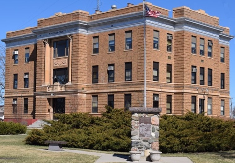
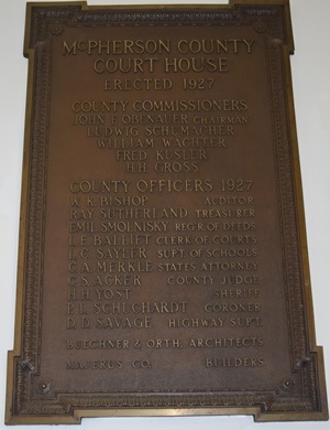
McPherson Co. Courthouse – located in Leola, SD
History
McPherson County was founded in 1873 and was named after a civil war general by the name of James B. McPherson. The County was established in 1873 by the Territorial Legislature. The original county boundaries included land now in North Dakota and excluded a small area along the eastern border that is now within the county. The present boundaries were established in 1885 and the first permanent settlers arrived in 1882. The geographic area of McPherson County is 1,137 square miles of land and 15 square miles of water. In March of 1884, Leola was made the county seat. Leola is situated at the intersections of SD Highway 10 and SD Highway 45.
Geographic Background
The main industry in the county is agriculture. Most businesses within the county are agriculture-related or goods-related; necessary for serving the day-to-day needs of the rural population base. Soil is the most important natural resource in McPherson County. It provides a growing medium for crops and for the grass grazed by livestock. Other natural resources are ground water, wildlife, sand, and gravel. Sand and gravel are deposited in scattered areas throughout the county. These deposits range from a few inches to more than 50 feet in thickness. They consist mainly of fine to coarse sand and some gravel, silt, and clay. Because of an excessive amount of fine rock fragments, such as shale, chalk, and clay ironstone, the sand and gravel are unsuitable as concrete aggregate or as construction material. They are suitable, however, as subgrade material for roads and as bituminous aggregate.
The central and western parts of McPherson County are on the Missouri Coteau. The contour of the land is undulating to hilly. Many potholes or closed depressions exist in the central and western parts of the county, and the drainage pattern is poorly defined. Spring Creek is the main drainageway. It flows westward to the Oahe Reservoir. The eastern part of the county is on the Drift Prairie part of the James River Lowland. Relief is dominantly level to undulating.
The drainage pattern is well defined. The two principal drainageways are Foot Creek and Snake Creek. They flow southeast to the James River. Land elevations range from 1,400 feet above sea level in the southeastern part of the county to about 2,100 feet in the north-central part of the county.
Crompton, Elm, Eureka, Leola, and Wolff Lakes provide opportunities for fishing, boating, and waterfowl hunting. The drainageways flow only intermittently and provide water only during periods of snowmelt and high rainfall. In some areas shallow ground water of good quality is available in sufficient volume for irrigation.